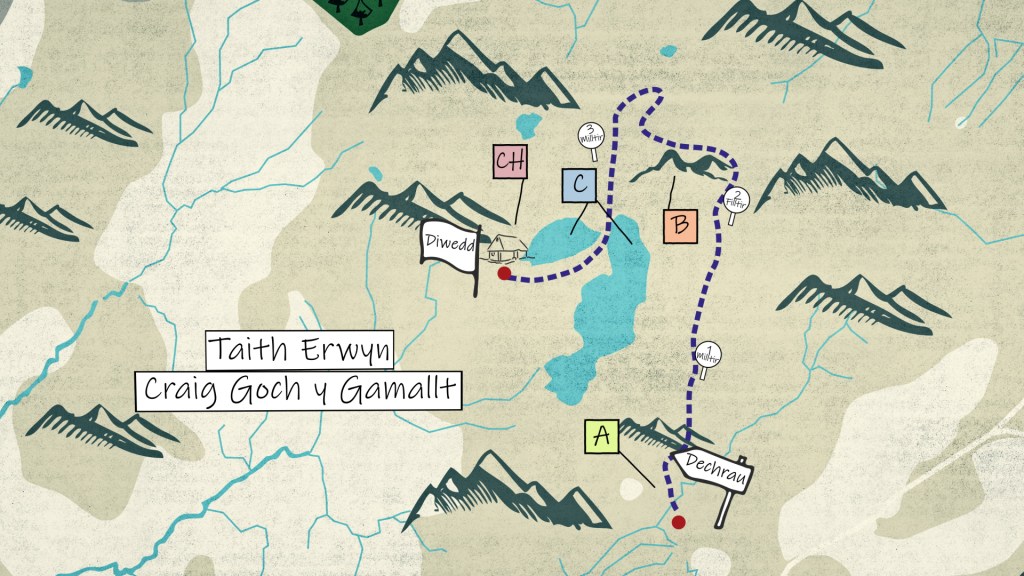
Duration: 1 hour and a half
Distance: 2 miles / 3.2 km
Start: SH 751 432
End: SH 745 443
Parking: There's no direct post code to the car park, you could find using this grid reference: SH 745 424, or by following these directions from Pengwern Hotel, Sgwâr yr Eglwys, Llan Ffestiniog LL41 4PB.
Turn left along the B4391, and keep right to join the A470. After leaving Llan Ffestiniog, take the first left signposted Bala B4391.
Follow this road, passing Cwm Cynfal, and turn left towards Ysbyty Ifan on the B4407. After 0.3 miles, you'll see a car park on your left. Park here and walk along the B4407 for 15 minutes and you'll see tracks on the left. This is where the walk starts.
There is no dedicated path marked for this walk until you reach the lakes. From the starting point on the tracks, walk across the Migneint (A) for half a mile. You'll then start to climb the Graig Goch (B). Go straight up, and across the top of the Graig Goch for around half a mile and you'll reach the Gamallt's summit. From here, walk towards the Northwest for 0.2 miles to reach Clochdy summit.
Continue across the cliff, and then down between both mountains with Graig Goch y Gamallt on your left, and Clochy on your right towards the Gamallt Lakes (C).
Walk between both lakes and you'll reach the Fishing Hut (Ch). This is the end of walk. To walk back to the start, walk towards the Southeast towards the bottom of the larger lake.
From the bottom of the larger lake, walk towards the Southeast for half a mile and you'll find the track. When the track reaches the road, turn right and walk alongside the road back to the car park.
A) Migneint
Grid Reference: SH 751 433
The Migneint is a moorland that stretches nearly 200 km square. This is one of the biggest blanket bogs in Wales.
B) Craig Goch y Gamallt
Grid Reference: SH 752 447
The Gamallt stands at 588m above sea level. Cliffs form the entire western side, this is the Graig Goch.
C) Gamallt Lakes
Grid Reference: SH 748 444
Two lakes form the Gamallt Lakes, one bigger than the other. It's a popular fishing spot, with the best fishing end of June.
Ch) Fishing Hut
Grid Reference: SH 745 443
This is an old shooting hut which is now used as a shelter for people fishing in the lakes